
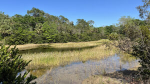
Riverbend Park was more than a decade in the making. The 680 acre preserve near Jupiter is an ideal destination for hikers who want a taste of the wilds of Southwest Florida without getting their feet wet.
Nearly 10 miles of interconnected trails make up the trail network, engineered, broad walkways of compacted limestone. An additional 7 miles of equestrian trails afford a more natural surface.
There is no shortage of wildlife here. We spotted armadillos, white-tailed deer, and wild turkeys as well as woodpeckers and wading birds while hiking for several hours.
Signage and kiosks make it nearly impossible to get lost. It’s nature, tamed, making it accessible to nearby city dwellers who’d otherwise never take a hike.
 Cypress knees along the Loxahatchee River floodplain
Resources







Disclosure: As authors and affiliates, we receive earnings when you buy through our links. This helps us provide public information on this website.
Overview
Location: Jupiter
Length: 6.5 miles in a larger trail network
Trailhead: 26.933152, -80.175023
Address: 9060 Indiantown Road, Jupiter
Fees: Free
Restroom: At the trailhead
Land manager: Palm Beach County
Phone: 561-966-6617
Open sunrise to one hour before sunset daily. Pets are not permitted. Strollers welcome. Trails shared with bicycles.
Jupiter Outdoor Center, located at the park’s entrance, rents canoes and kayaks for paddling the Loxahatchee River and river remnants tied together as watery trails.
Directions
Riverbend Park is along Indiantown Road (SR 706) to the west of Jupiter, 1.5 miles west of the interchange with Florida’s Turnpike and Interstate 95.
Hike
Start at the entrance kiosk, which is topped with chickee thatch. It’s a theme you’ll see reflected throughout the park: lots of chickee thatch kiosks, plenty of signs, and big chickee huts.
It pays homage to the historical and archaeological significance of this site. This is sacred ground, with a permanent Seminole encampment for ceremonies.
Within the park’s borders, the Loxahatchee River Battlefield Park north of the parking area honors the Battle of the Loxahatchee.
On January 24, 1838, Federal troops attempted to remove the Seminole from this region to the west.
 Entrance boardwalk
The trail starts with a boardwalk through a lush stand of cypresses and ferns near the Loxahatchee River. Hiking the perimeter of the trail system takes about 3 hours and about 6.5 miles.
To walk clockwise around the park, start on the Hunt Camp Trail, which begins at the end of the entrance boardwalk.
Follow it to the Pine Walk, which skirts around a wildlife refuge area where you’ll likely see deer.
This meets the East Slough Trail, which in turn reaches the Ocean to Lake Hiking Trail, a segment of the statewide Florida Trail, blazed in orange.
Within Riverbend Park, it defines the eastern edge of the trail system, running along its edge for 1.4 miles. It also extends well beyond the boundaries of the park.
 Ocean to Lake Hiking Trail
Making a left here leads to Jonathan Dickinson State Park and eventually the Atlantic Ocean at Hobe Sound Beach. But within a mile of this turn are two worthwhile spur trails into the Wild and Scenic portion of the Loxahatchee River basin.
 Italian Farms Trail A round-trip through former tomato farms reclaimed by second-growth forest, this multi-use trail through Loxahatchee River Management Area leads to the Masten Dam.
 Lainhart Dam Trail Glimpse a small part of the beauty of the Loxahatchee Wild and Scenic River basin on this easy round-trip trek to Lainhart Dam and the river bends beyond.
To stay within Riverbend Park, turn right. It is a broad path, passing impoundments where ospreys and egrets perch in the trees, crossing creeks and slipping through cypress domes. It passes a side trail to the Seminole encampment.
Turn right after 1.5 miles to follow the Grove Trail to the Orange Grove Picnic Area, with its big chickee pavilion.
 Orange Grove Picnic Pavilion
The side loop between the Grove Trail to the Hunters Loop provides great birding along South Pond.
From the picnic area, head north on the Grove Trail and when you reach Reese Blvd, turn left.
This long causeway leads through a floodplain forest to the Big Hammock, where the Hammock Loop Trail circles the picnic area.
 Along South Pond to Big Hammock
Either return on Reese Blvd or take the West Equestrian Loop to get to the north edge of the park, where Portage Trail and Wildlife Loop Road meet.
Follow the River Walk Trail from here. It’s one of the most scenic walks in the park, paralleling the Loxahatchee River. Tall cabbage palms shade the trail, and ancient cypress stand sentinel.
Use the Military Loop Trail to return you to Reese Blvd and walk a short distance back under the dense palms to the Hunt Camp Trail to exit.
 Kiosk at Pond Trail junction
Trail Map

Explore More!
Slideshow
See our photos of Riverbend Park
Nearby Adventures
 Cypress Creek Natural Area Protecting an expanse of wet habitats along the Loxahatchee River floodplain, Cypress Creek Natural Area is central to the Jeaga Wildways trail network in Palm Beach County.
 Jonathan Dickinson State Park One of South Florida's best backpacking destinations, Jonathan Dickinson State Park encompasses a vast mosaic of ecosystems along the wild and scenic Loxahatchee River.
 Florida Trail, Ocean to Lake: Luckey Tract to Kitching Creek 10.7 miles. A hike of extreme contrasts, this segment of the Florida Trail crossing Riverbend Park and Cypress Creek connects Loxahatchee Slough with Jonathan Dickinson State Park.
 Limestone Creek Natural Area Centered on pine flatwoods along a historic creek basin lined with mangroves, Limestone Creek Natural Area is a green gem in a busy corner of Jupiter.

- Baseline Trails - November 7, 2026
- Hal Scott Yellow Trail - November 3, 2026
- Hal Scott Preserve - October 28, 2026