
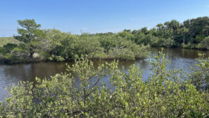
The boardwalks of Betty Steflik Memorial Preserve connect an island of coastal uplands with the Intracoastal Waterway and the waterfront of downtown Flagler Beach.
Established in 1995, the preserve protects an expanse of marshes behind this beach community, important habitat for wading birds and osprey.
 Sunrise often brings sea fog off the nearby Atlantic Ocean
There are three entrances, two of which lie at the ends of the boardwalk: behind the Flagler Beach library downtown and at the Moody Boat Launch.
This hike starts at the preserve’s main parking area on an island in the mangrove forest, which has a large picnic shelter with restrooms.
 This is a fabulous destination for birding
Resources





Disclosure: As authors and affiliates, we receive earnings when you buy through our links. This helps us provide public information on this website.
Overview
Location: Flagler Beach
Length: 2 miles
Trailhead: 29.476315,-81.133278
Address: 815 Moody Ln, Flagler Beach
Fees: Free
Restroom: At the trailhead
Land Manager: Flagler County
Phone: 386-313-4020
Open daily dawn to 11 PM. Leashed dogs welcome.
Directions
From Interstate 95, follow SR 100 east several miles to Flagler Beach. Cross the bridge over the Intracoastal Waterway. Turn left at the light for Flagler Ave. At the next corner, make a left to follow Moody Lane back beneath the SR 100 bridge. Watch for the sign beneath the bridge pointing left to the road into the preserve. Park near the picnic pavilion.
Hike
Begin at the boardwalk adjoining the picnic pavilion. Spanning a sand ridge between the parking area and the hammock, it provides a safe haven for gopher tortoises.
Many live on the high ground of this island. Quite a few burrows are in evidence, and usually one of the tortoises is too, munching on grass edging this sliver of coastal scrub.
 It’s not unusual to see large gopher tortoises here
Descend beneath the canopy of cedars and cabbage palms to the hammock rim of the island. Make a left off the boardwalk down the ramp.
Start a counterclockwise circuit of the island’s perimeter. Sometimes soggy, this dark earthen path sticks to the ecotone between palm hammock and mangrove forest.
 Start of the Island Loop
Benches sit in the shade. The tangled roots and limbs of the mangroves stand in stark contrast to the palms and the smooth trunks of the many large cedars.
A tunnel effect continues until the landscape opens up on a curve where sea purslane thrashes wildly in the breeze, the SR 100 bridge looming ahead.
 Nearing the bridge
Curve left along a corridor of Virginia willow. Walking beneath the palms, emerge at the park road at 0.4 miles, the picnic pavilion within sight.
Following the hiker symbol sign, cross the road into a mature coastal hammock, shade provided by the canopy of intertwined limbs of live oaks.
 Park entrance road crossing
Beyond a bench, continue up and over a rise past mounds topped with cedars and palms. Bear right at the trail junction to join the boardwalk.
Extending towards the highway bridge, it reveals a cove of marsh before crossing a tidal creek lined with black mangroves.
 Bench in the coastal hammock
At the end of the straightaway, face the Moody Boat Launch at a T intersection. Turn left to follow the boardwalk towards the Intracoastal Waterway.
It ends at a ramp to a patch of white sand used as a kayak launch.
Return to the junction and walk around the boat basin on the boardwalk, fruitful for birding when it isn’t busy.
 Boardwalk to Moody Park
At 0.6 miles, the boardwalk ends at the edge of the boat ramp within sight of the restrooms.
Return the way you came back to the island. When the boardwalk ends, make a right, passing a bench to walk beneath grand old cedars beside the mangroves.
 Island footpath under the cedars
A spill of shell material into the footpath under the shade of the oak canopy indicates the presence of mounds under the forest canopy.
These shell mounds may date to the Timucua people who lived on these shores when the first Europeans arrived.
 Finishing the Island Loop
At 0.9 miles, meet the incoming boardwalk from the parking area where you initially left it in the other direction.
Make a right to resume it in the one direction left unexplored. Leaving the island behind, it rises to cross a tidal creek.
 Crossing the tidal creek
Mangroves have conquered more ground on what was once a patchwork of needlerush and sea oxeye.
Spanning an island where cabbage palms still rise above the mangroves, walk adjacent to a gazebo, reaching a T intersection. Turn right.
 Gazebo
This straightaway spur leaves the island to span open water, ending at an observation platform on the Intracoastal Waterway.
A mile into the hike, it’s a good place to watch for manatees and dolphins. It is often busy with anglers fishing off the platform.
 Observation deck on the Intracoastal Waterway
Return to the intersection and continue straight ahead past the incoming boardwalk and the gazebo, paralleling the connecting waterway.
Cross the tidal creek again to reach a covered shelter with a bench. It adjoins another inlet where herons and egrets stalk fish.
 Tidal creek
Beyond the shelter is the longest of the round trips along the boardwalks. It’s a very scenic walk with views in all directions.
Hover above a mound of island in the marsh edged by sea oxeye, and look out across thin strips of mangrove islands and oyster bars.
 The longest stretch of boardwalk
Fiddler crabs navigate a maze of pnuemataphores on sandspit beachs, where young mangroves steadily claim the high ground.
Spanning another pool of open water among the mangroves, the boardwalk has a few mild zigzags along its otherwise linear route.
 Trailhead behind the Flagler Beach Library
The boardwalk ends at the line of palms at 1.4 miles on a strip of parkland edging the estuary along the public library parking lot.
Return the way you came, scanning the mangroves and waterways for wildlife. Reach the gazebo at 1.8 miles.
 Deer crossing shallows at low tide
Turn right just past the gazebo to exit, this time staying on the boardwalk straight through the loop junction.
Rising up the boardwalk onto the sand ridge, watch for gopher tortoise activity. End your hike at the picnic pavilion after 2 miles.
 Gopher tortoise area along boardwalk
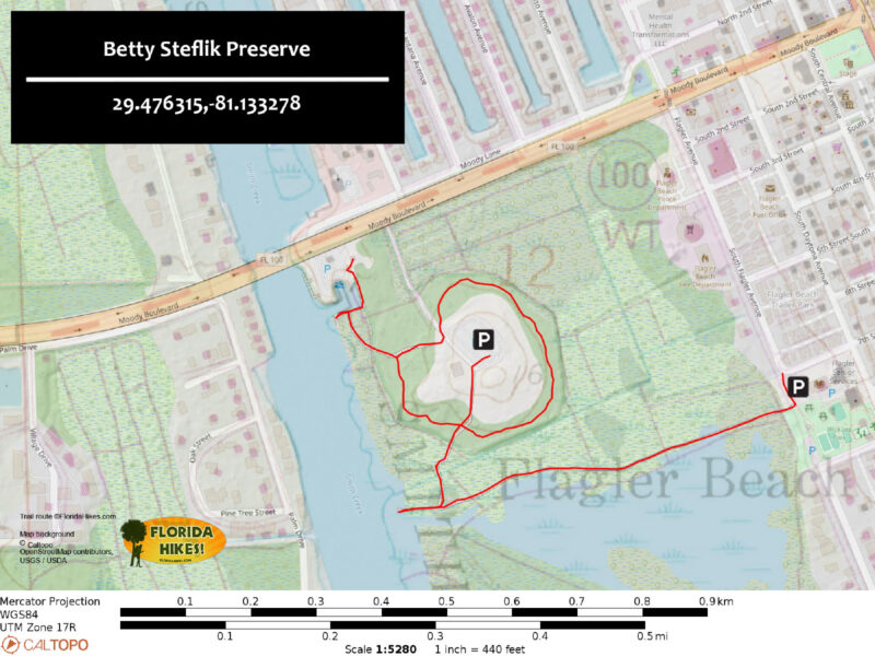
Trail Map
Explore More!
Video
Hiking Betty Steflik Preserve
Slideshow
See our photos from Betty Steflik Preserve
Nearby Adventures
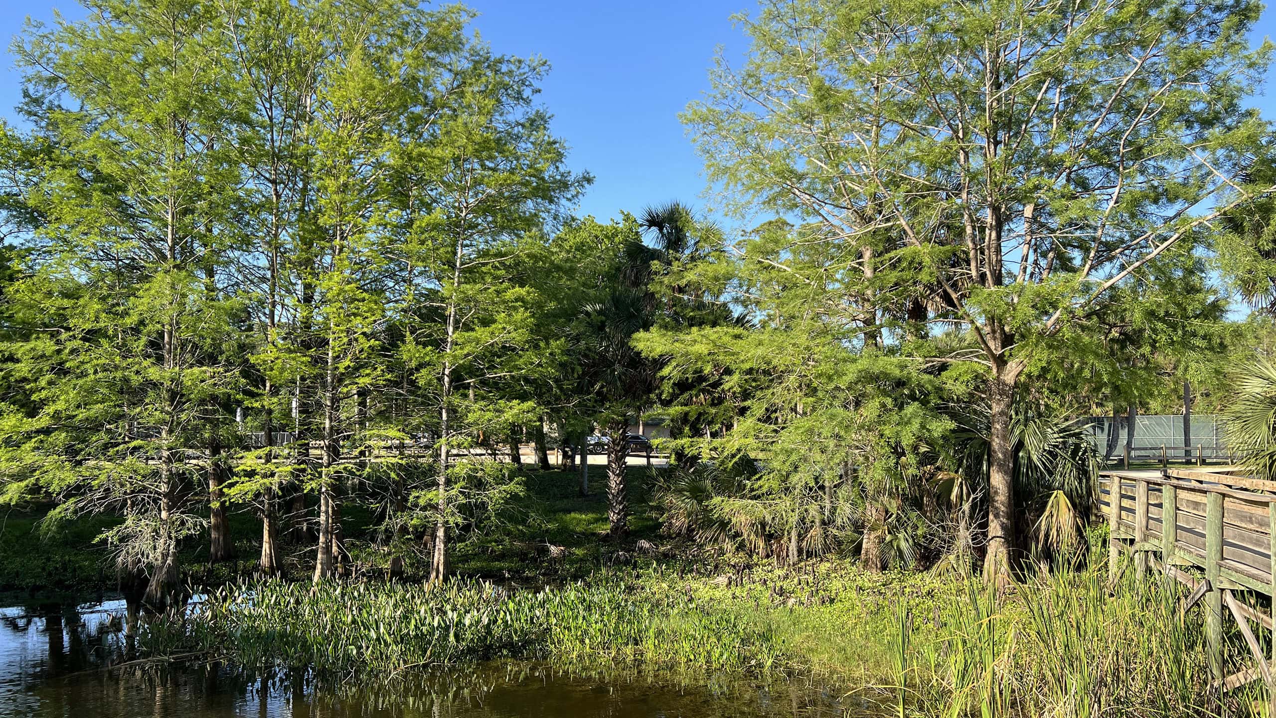 Wadsworth Park Edging a tidal creek flowing towards the Intracoastal Waterway, this recreational park has a showy boardwalk and a short walk through a coastal hammock.
 Graham Swamp East Hiking Trail A surprisingly rugged hike along a ridgetop threads between two sides of a mountain bike loop on the eastern side of Graham Swamp Preserve.
 Bulow Creek Wahlin Trail Beyond the Fairchild Oak, the centerpiece of the main trailhead at Bulow Creek State Park, the interpretive Wahlin Trail delves deeper into Bulow Hammock.
 Joe Kenner Trail Explore two sides of Gamble Rogers Memorial State Recreation Area on a mile loop encompassing a lush coastal hammock and a view of the Atlantic Ocean.

- Baseline Trails - November 7, 2026
- Hal Scott Yellow Trail - November 3, 2026
- Hal Scott Preserve - October 28, 2026